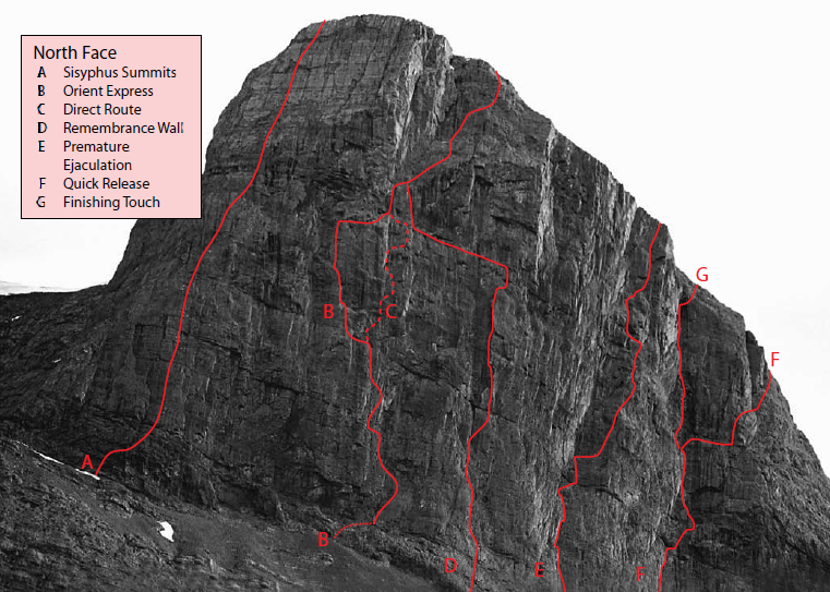
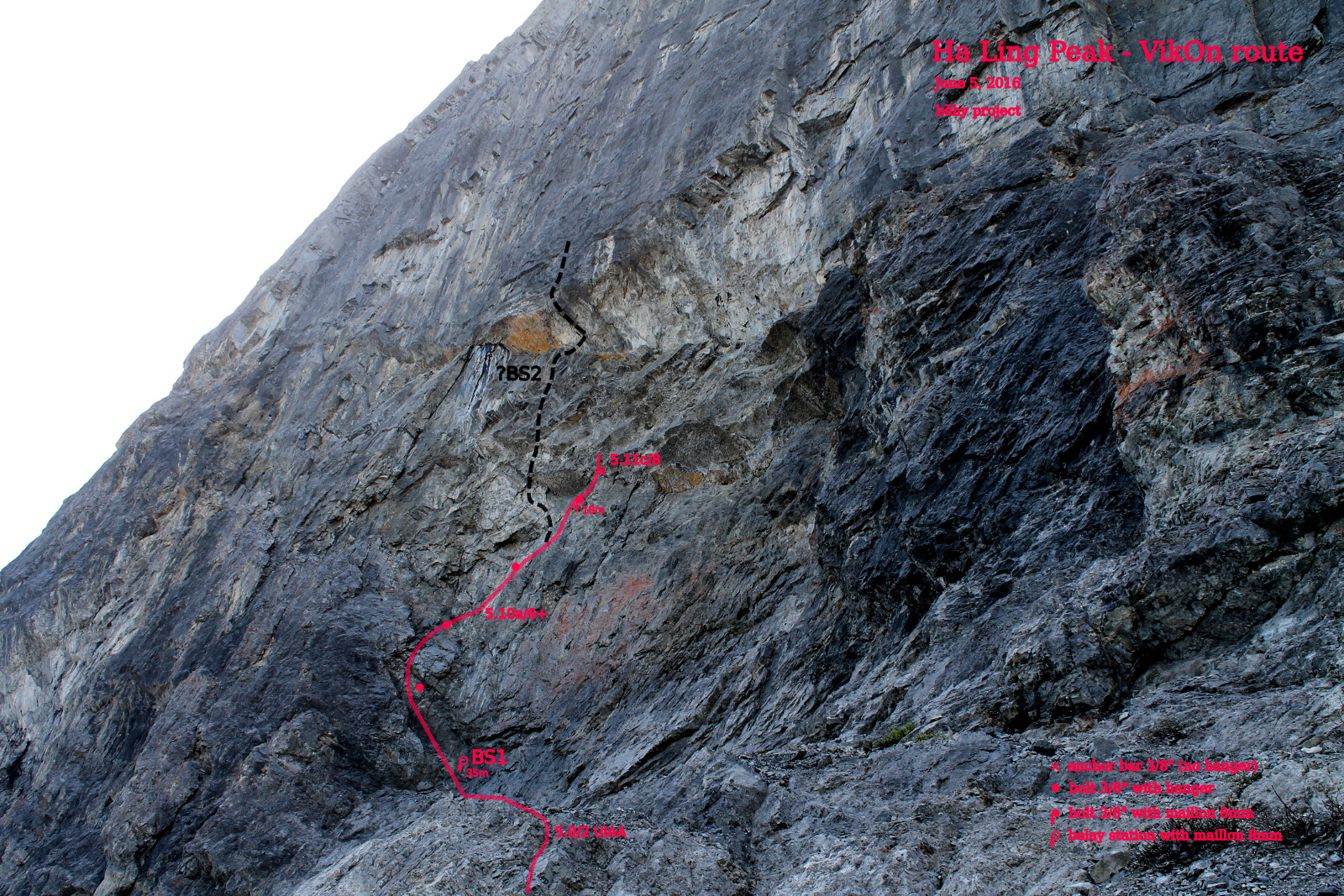
On Sunday November 1st, 2015 the first stand (belay station) of a new climbing route called by working name “VikOn” has been placed in the North Face of Ha Ling Peak (2407 m/7897 ft), Canmore, Alberta. The beginning of the route is situated between existing routes “Sysiphus Summits” (A) and “Orient Express” (B).
GPS position of the beginning on the trail: 51°03’54.6″N 115°23’52.9″W
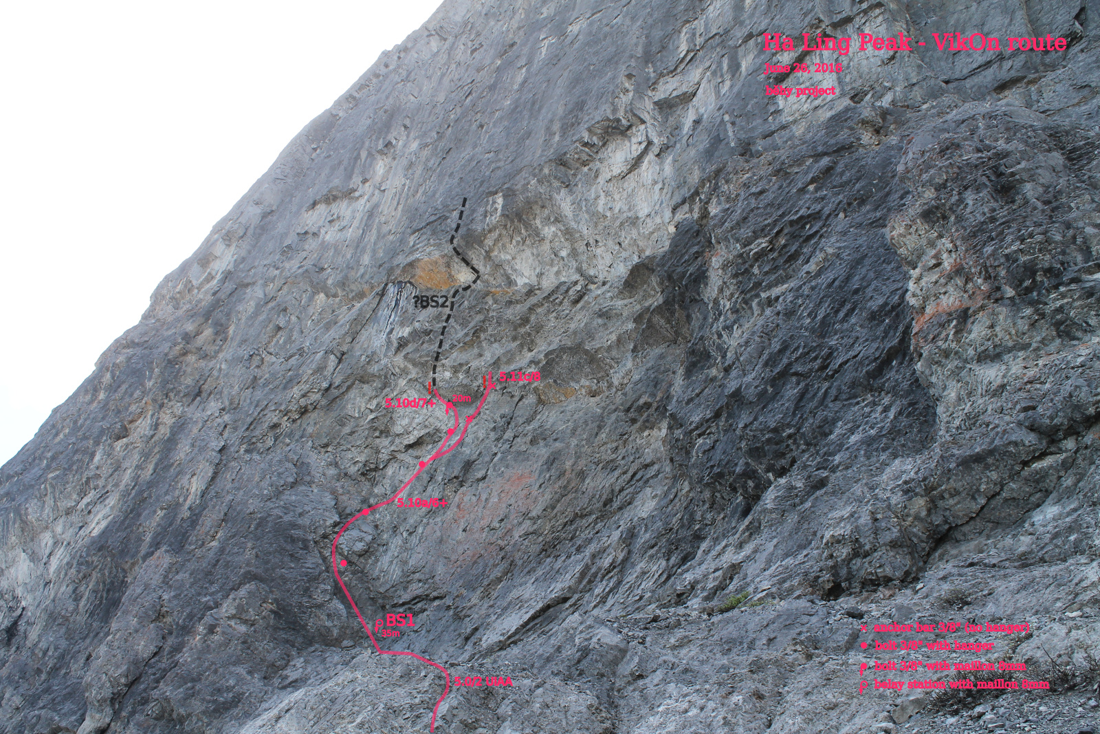
L1 – access pitch 2 UIAA (5.0, length cca 35 m), Starts on the hiking trail under the North Face. Ends at the eastern end of the angled ledge in the corner (belay station BS1).
BS1 GPS: 51°03’54.3″N 115°23’52.2″W
L2 – second pitch cca 7+ UIAA (5.10d, cca 20 m), Starts in the corner on the angled ledge (BS1). In progress currently. There are big loose stones in the overhang above and left of the bolt #5 (left “black” variant). Loose stones in 50% of the length!
Anchor bar #5 (right “white” variant) sits in the loose “exfoliated” rock! No hangers left in the right variant.
Short videos from setting of it:
Beginning of the L2
The right “white” variant of the L2.
The left “black” variant of the L2
Authors:
Ondřej Běhal, Czech rock climber and mountaineer, Rock climbing instructor of the Czech mountaineering association
Mirek Fiala, Czech mountaineer and pow rider